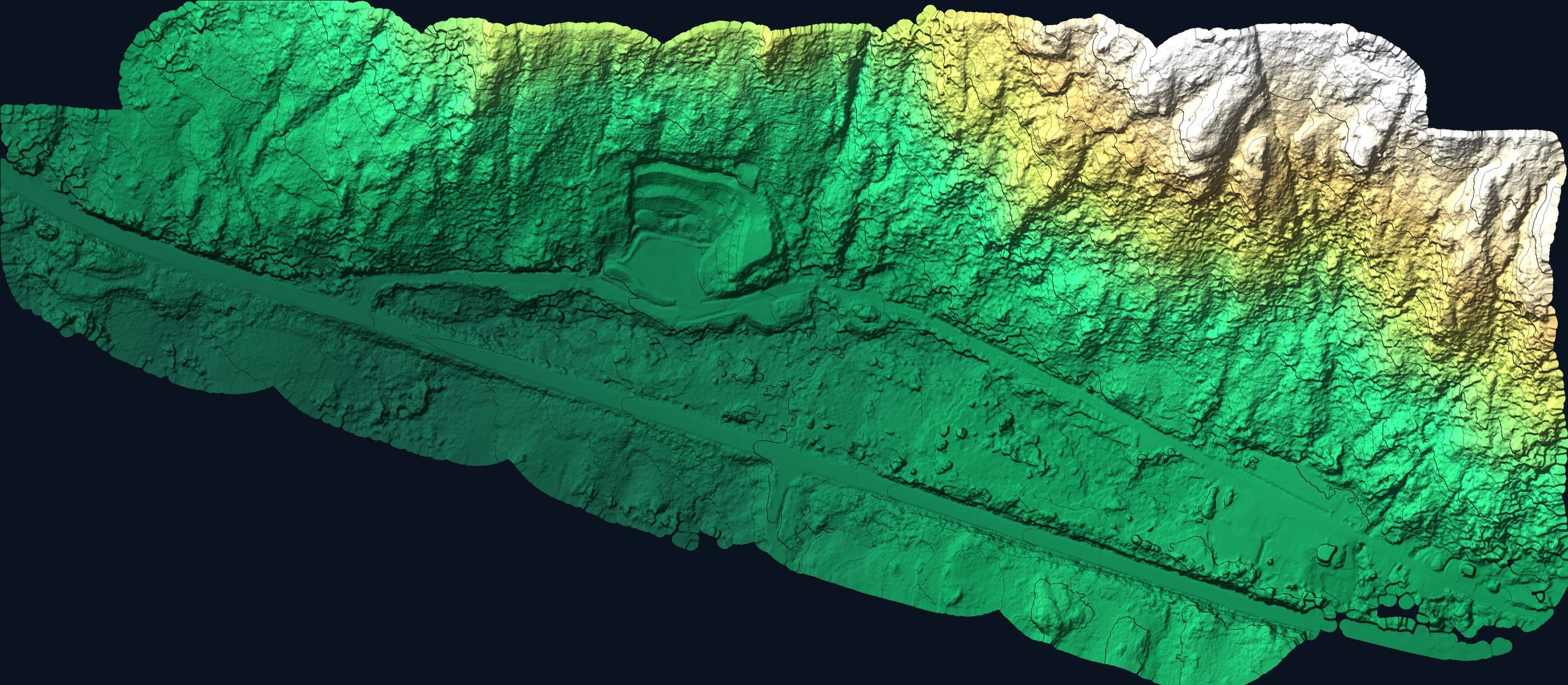
Bare Earth · Under Canopy
Drone LiDAR
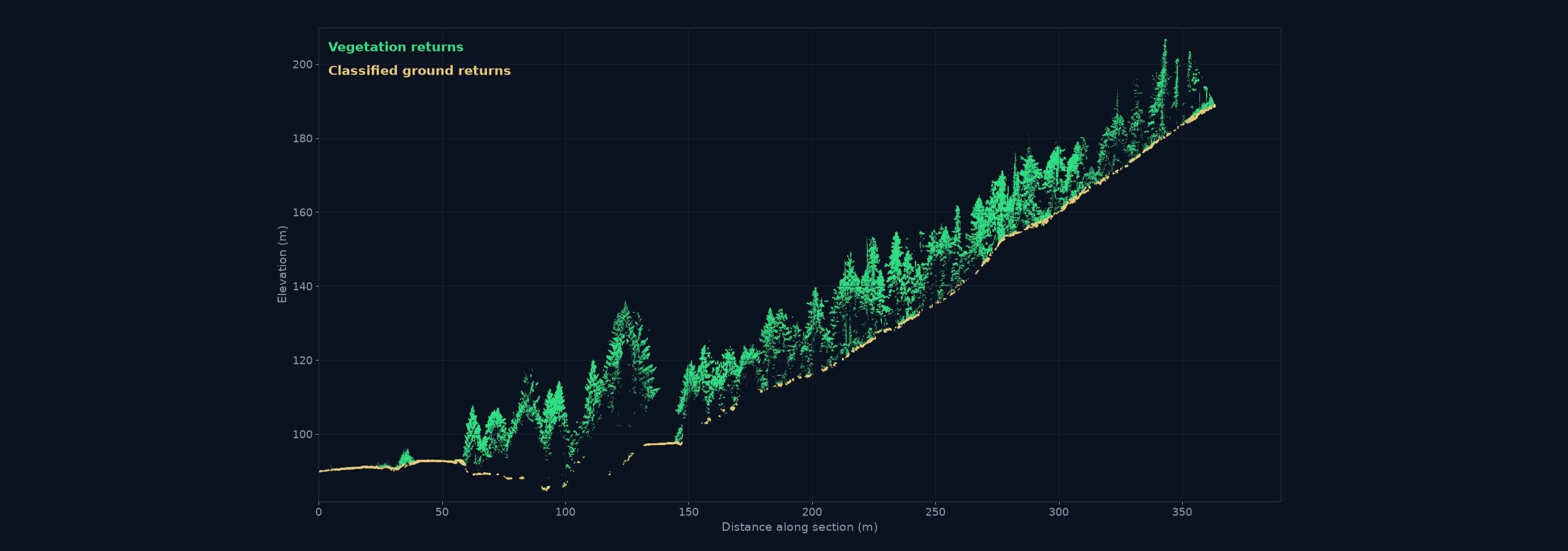
Most of Vancouver Island is covered in trees, which means most of Vancouver Island can't be honestly mapped by cameras alone. LiDAR measures with laser pulses, and enough of them slip through the canopy to return the actual ground. It's how forested Island terrain gets mapped for real.
We deploy drone LiDAR where it earns its cost: forested parcels, corridors through mixed cover, steep vegetated ground, and any project where 'the surface' has to mean the dirt, not the treetops.
Why LiDAR for this Island
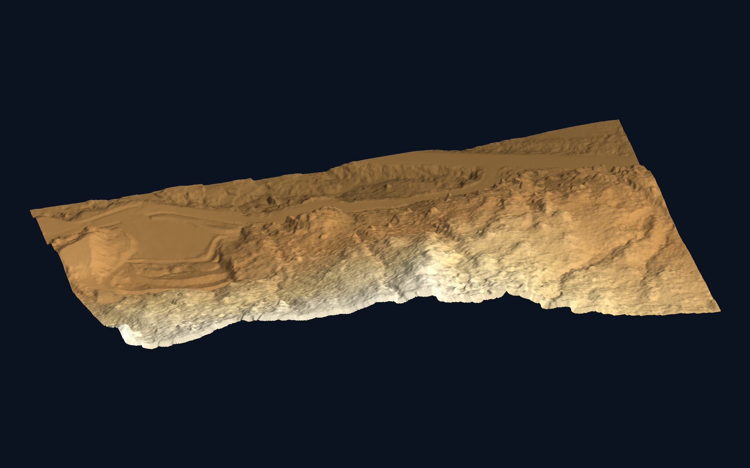
Coastal second-growth is dense, tall and continuous. Under it, photogrammetry maps canopy and GNSS struggles for sky. LiDAR is the practical answer: high-density laser measurement from above, classified to separate vegetation from ground, delivering bare-earth surfaces that would take ground crews weeks, or simply wouldn't happen.
What we deliver from a LiDAR flight
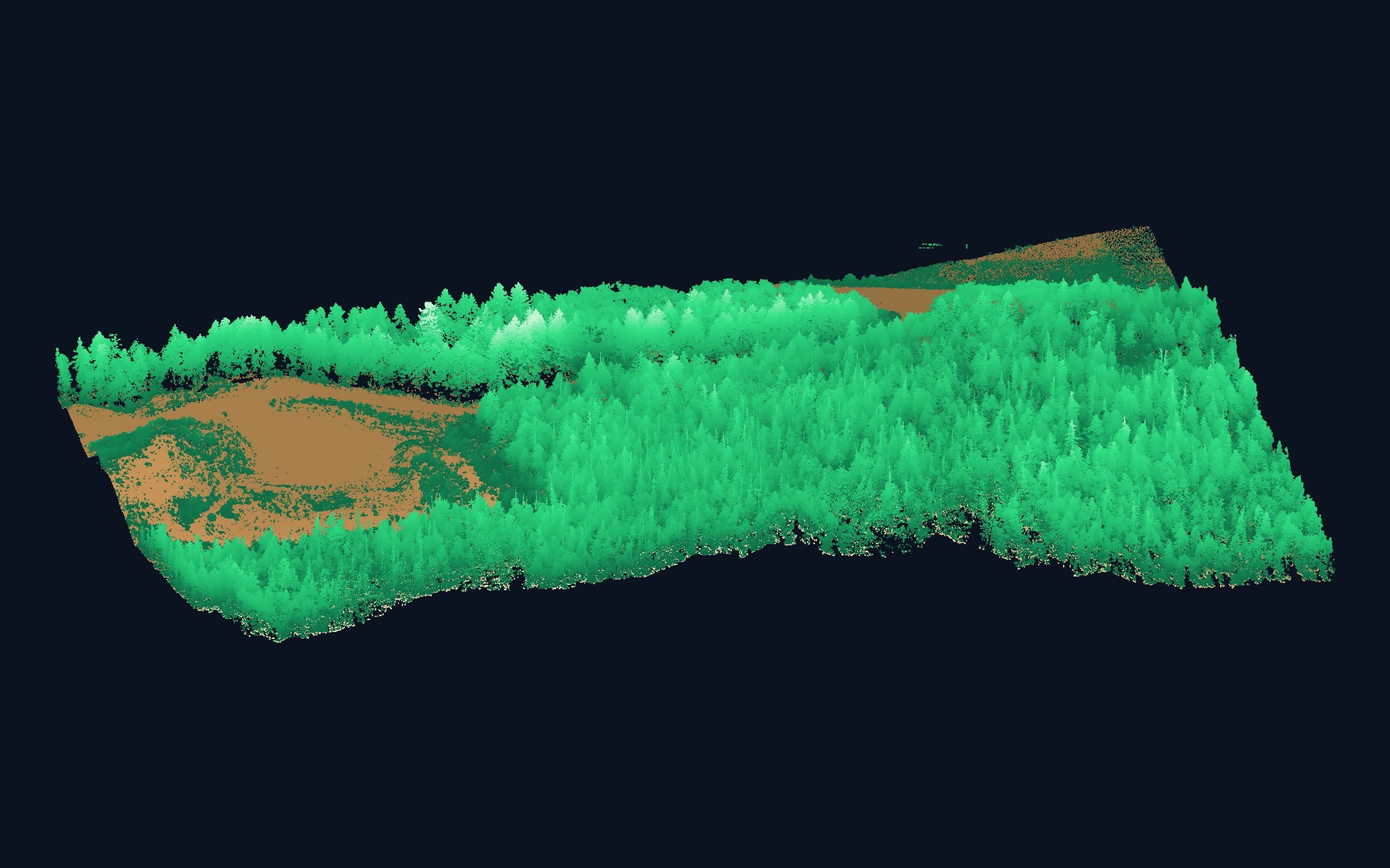
- Classified point clouds (ground / vegetation / structures)
- Bare-earth terrain models (DTM) and contours
- Cross-sections and profiles along corridors
- Canopy and vegetation metrics where useful
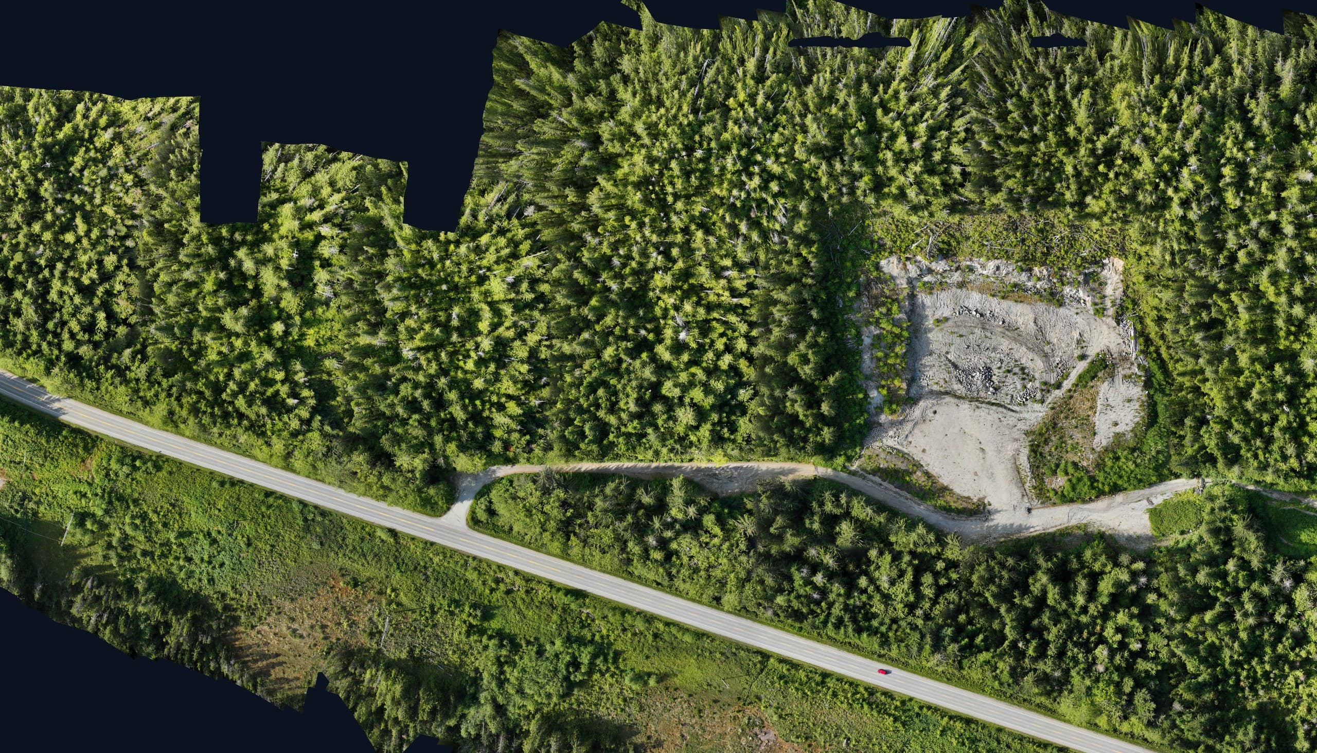
- Combined LiDAR + orthophoto packages
Processing is half the product
Raw LiDAR is a cloud of everything. The value is in classification and QA, separating true ground from understorey in aggressive Island vegetation, and verifying the surface against independent ground checks before it ships. That's processing craft, and it's where datasets are made or ruined.
From a real flight
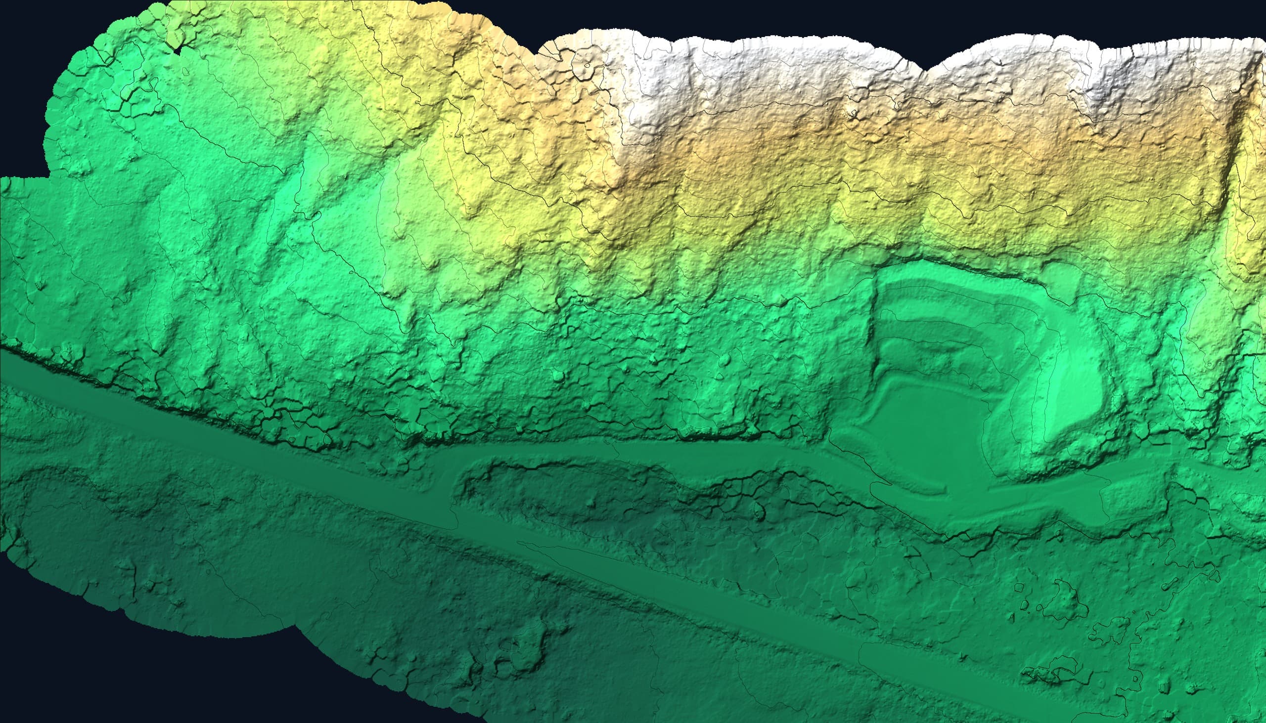
The data, not the brochure.
Deliverables
- Classified LAS/LAZ point cloud
- Bare-earth DTM
- Contours
- Corridor sections
- Accuracy report with ground checks
Coverage
Available across Vancouver Island.
LiDAR is our workhorse for the Island's working land: forestry parcels north of Campbell River, valley-wall terrain around Port Alberni, large rural properties from Cowichan to the North Island, all flown from our Courtenay base with access planned for resource-road realities.
Common questions
LiDAR or photogrammetry, which do I need?+
Open ground: photogrammetry. Trees over ground you care about: LiDAR. Corridors and mixed sites: often both together. Our insights article walks through the decision, or send us the site and we'll recommend honestly, including when the cheaper option is the right one.
How large an area can you cover?+
Drone LiDAR is efficient from a few hectares up to large multi-block programs flown over several days. For very large areas, we'll scope flight plans, access and processing timelines as a program rather than a single flight.
Related services
Fast, accurate aerial mapping for sites of any size.
Topographic SurveysAccurate existing-conditions data for design, planning and development.
OrthophotosMeasurable, georeferenced aerial imagery for planning and documentation.
Send us the scope.
Tell us what you need and where and we'll have pricing and a realistic schedule back within one business day.