North Island
4 min readDrone LiDAR Surveys: Campbell River, Port McNeill & Port Hardy
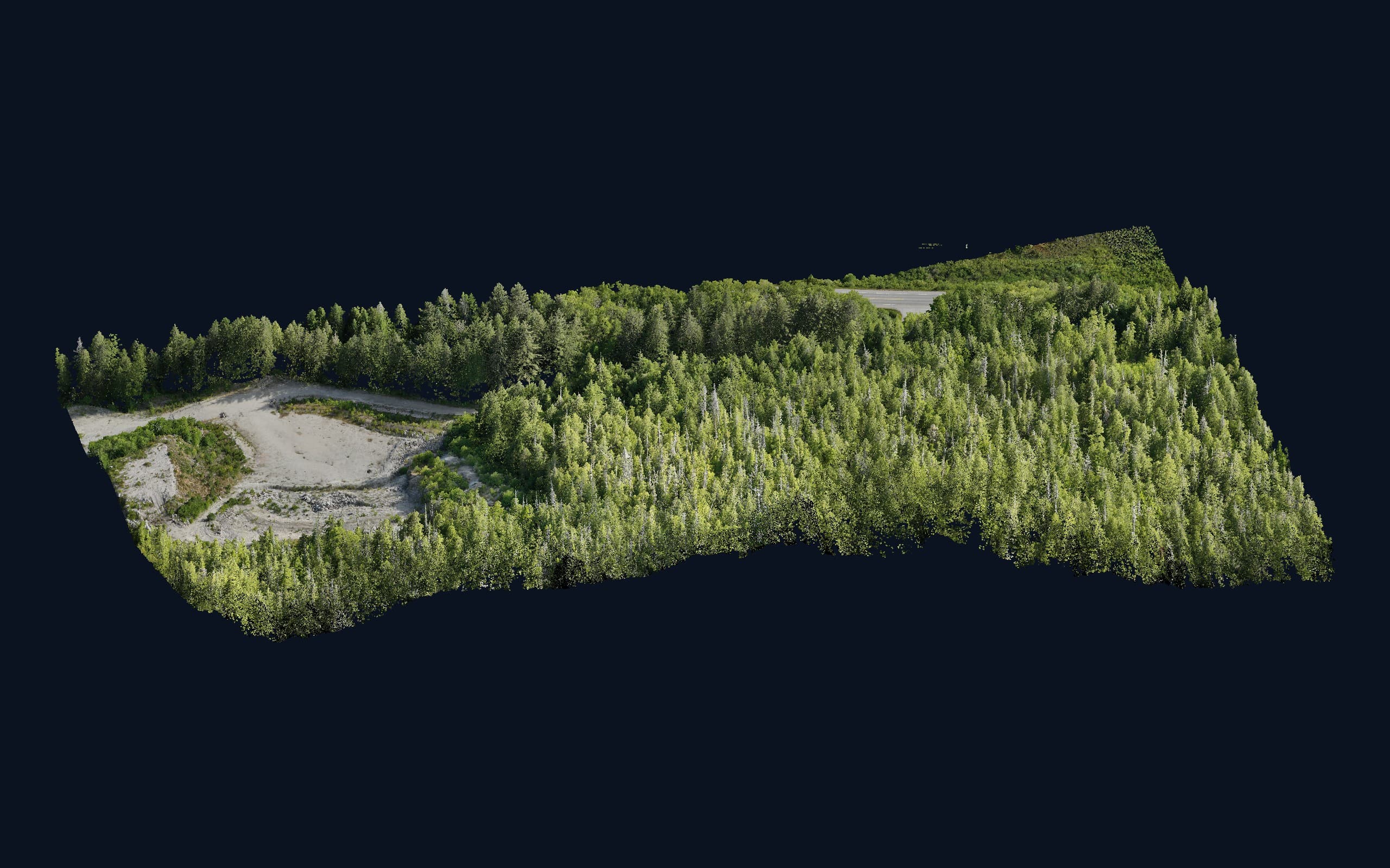
North of Campbell River, the Island stops pretending to be gentle. Second-growth forest closes over almost everything that isn’t highway, harbour or cutblock; the ground underneath it is steep, wet and cut by creeks that matter. If your project needs to know what that ground actually does — a resource road, a utility corridor, a pit expansion, a stream crossing, a slope you’re about to build below — a camera can’t tell you. It sees the treetops. Drone LiDAR sees the dirt.
Vancouver Island Geomatics flies drone LiDAR across the North Island from our base in Courtenay. This post covers what LiDAR delivers up here, how we work the Campbell River, Port McNeill and Port Hardy corridor, and what a North Island LiDAR job looks like from the first phone call to the last file.
Why the North Island is LiDAR country
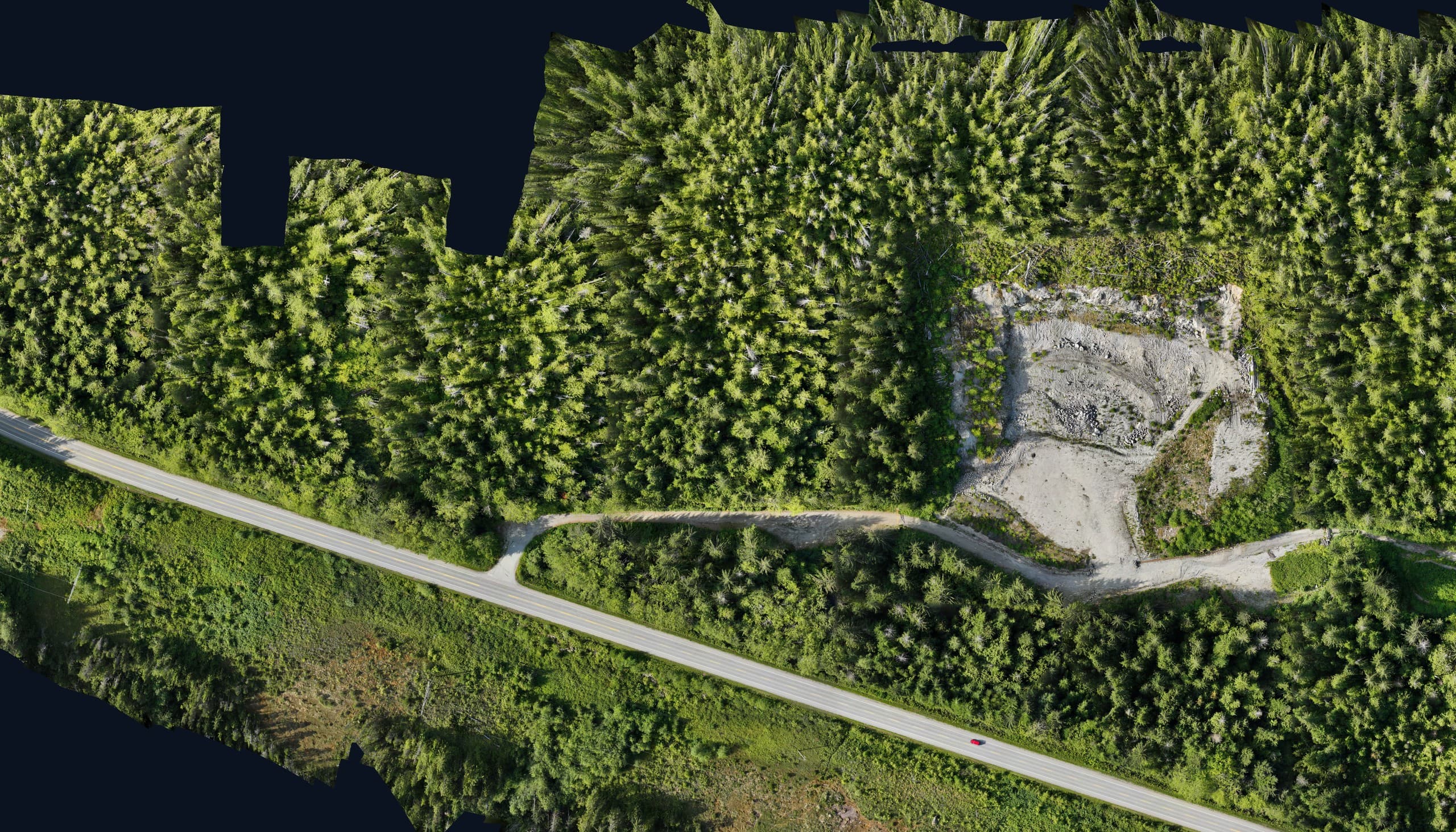
Photogrammetry — the drone-camera method — builds a surface from what the camera can see. Over an open pit or a cleared site that surface is the ground and the method is excellent. Over closed canopy it is the top of the forest, and a design built on it can miss the real ground by the height of a tree. Most North Island project ground is closed canopy.
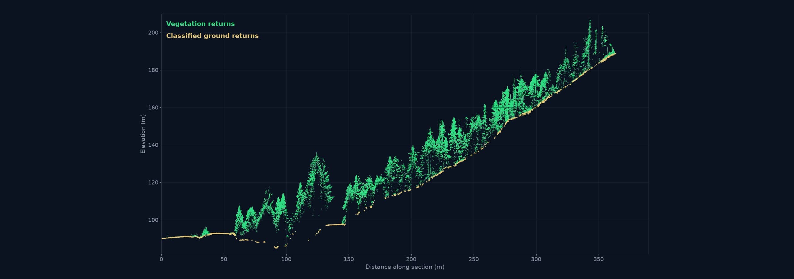
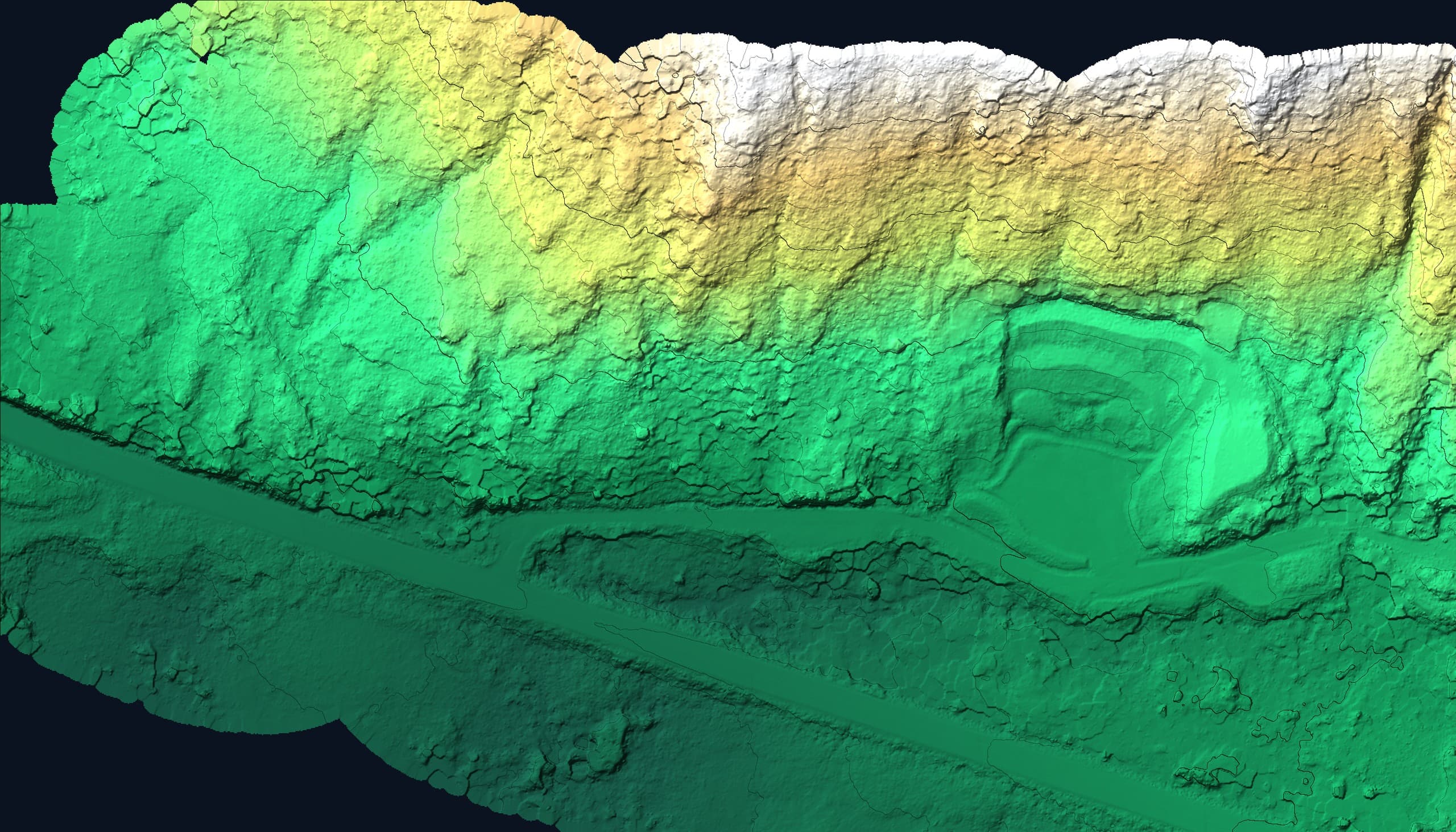
LiDAR fires laser pulses and records every return. Enough of them slip between branches to reach the forest floor, and after classification the ground returns are separated from vegetation to produce a bare-earth model: real terrain, real drainage, real slope, under the trees. The cross-section in the gallery below shows exactly that — canopy stacked above a hillside, and the clean classified ground line beneath it.
Corridor work is where LiDAR earns its keep
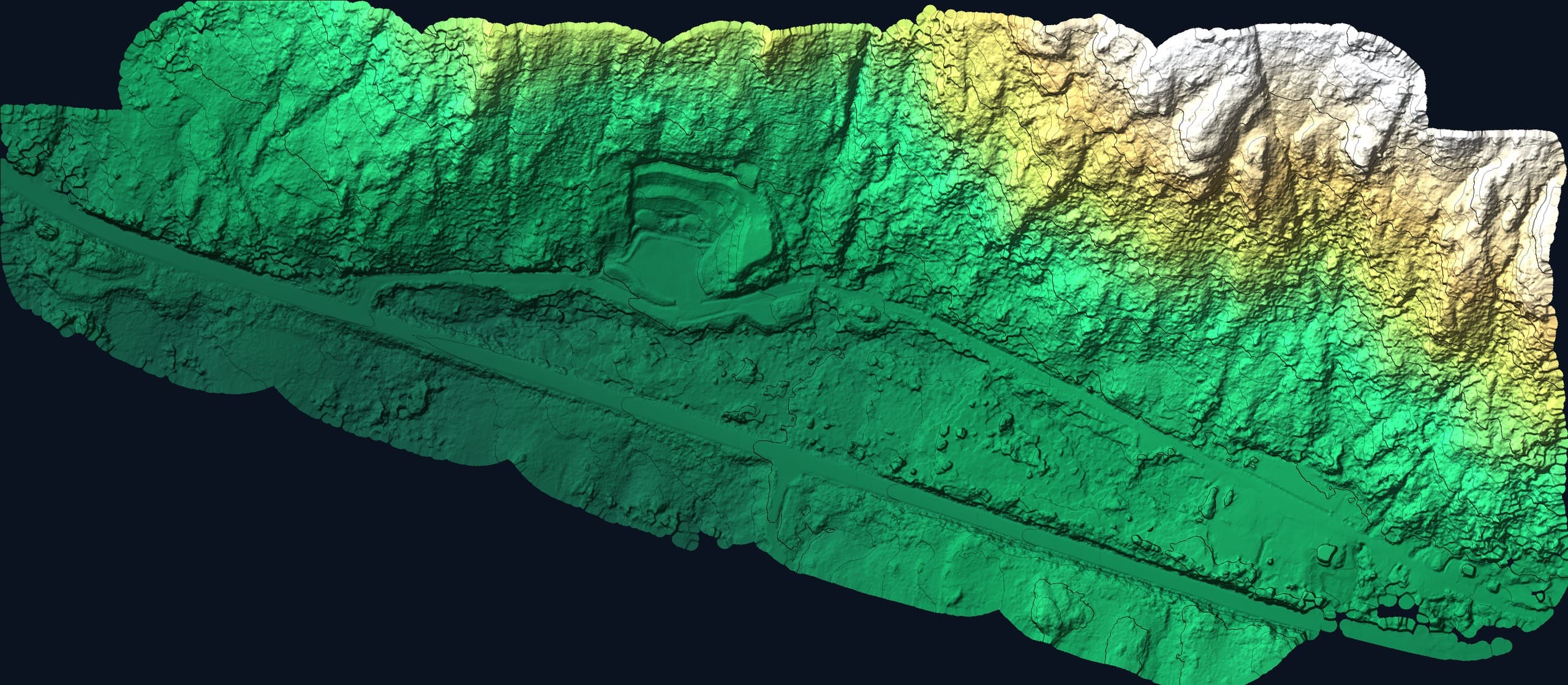
The North Island is a landscape of corridors: the highway north, the mainline and branch roads into the working forest, transmission lines, water and gas alignments, access to mines, quarries and remote sites. A corridor survey by ground crew is slow through timber and exposed on active roads. A drone LiDAR flight covers kilometres in a day and returns a continuous classified cloud along the whole alignment — bare-earth surface, contours, cross-sections at your interval and the vegetation model on top, all on one datum.
- —Resource road location, upgrade and deactivation design
- —Cutblock and road-network terrain for forestry planning
- —Transmission, water and pipeline alignment and clearance
- —Stream crossings, culvert sizing and riparian assessment
- —Pit, quarry and mine access and expansion terrain
- —Slope and hazard assessment above infrastructure and communities
Campbell River
Campbell River is the gateway to everything north and the working centre of the mid-Island’s resource economy — forestry operations, hydro and utility infrastructure, aggregate, marine and industrial sites, and a fast-growing city pushing development onto forested benchland. It is also under an hour from our base, which makes Campbell River LiDAR work routine rather than remote: single-day flights, quick re-flights when a design changes, and the same crew available for the ground survey that ties the LiDAR to your project control.
Port McNeill
Port McNeill is the North Island’s forestry hub and the doorway to the Nimpkish valley, the ferry to Alert Bay and Sointula, and a road network that reaches deep into the working forest. Terrain here is the classic case for LiDAR: steep, closed-canopy ground where road location, harvest planning and stream protection all depend on knowing the real surface. We plan Port McNeill flights as full-day runs from Courtenay, often paired with Port Hardy work so the mobilization is shared.
Port Hardy
Port Hardy is the top of the highway — harbour, airport, mining and aggregate operations, the road west toward Holberg and Cape Scott, and the communities and infrastructure that depend on a thin corridor of access. Weather windows are real here, and so is the cost of a wasted trip; we watch the forecast, fly when the ceiling allows, and use the same visit for any ground control, as-built or topographic pickup the project needs.
What a North Island LiDAR job delivers
Every deliverable is named in the quote and stated with coordinate system, vertical datum and accuracy:
- —Classified point cloud (LAS/LAZ) — ground, vegetation and structures separated
- —Bare-earth digital terrain model and contours at your interval
- —Corridor cross-sections and longitudinal profiles
- —Orthophoto flown alongside the LiDAR for context and mapping
- —CAD surface and breaklines ready for road and civil design software
- —Accuracy report with independent ground check points
How we work the North Island
Our base in Courtenay is the practical advantage. Campbell River is a morning start; Port McNeill and Port Hardy are planned runs, bundled so that travel is shared across projects instead of billed to one. We scope the flight from the corridor length, the canopy and the accuracy the design needs, fly with ground control on every job, and process and classify the cloud in-house so the person who flew your corridor is the one checking the ground model. If the project also needs construction layout, as-builts or a conventional topo, it is the same crew and the same datum.
Get a North Island LiDAR quote
Send us the alignment or the site, what the terrain data has to support, and when you need it. We will recommend LiDAR, photogrammetry or both, and quote within one business day.
Related service
Drone LiDAR
High-density point clouds and bare-earth terrain — even under vegetation.